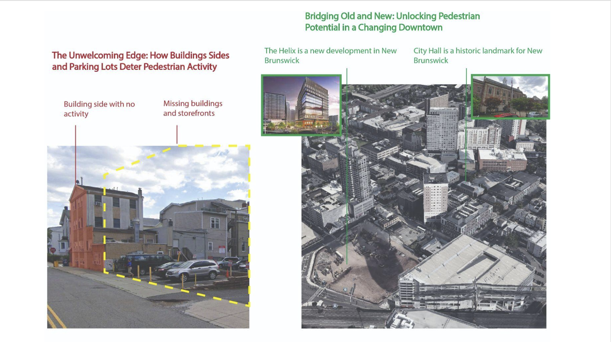
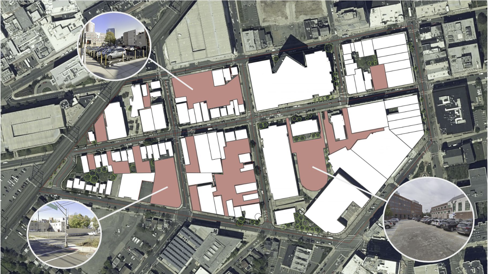
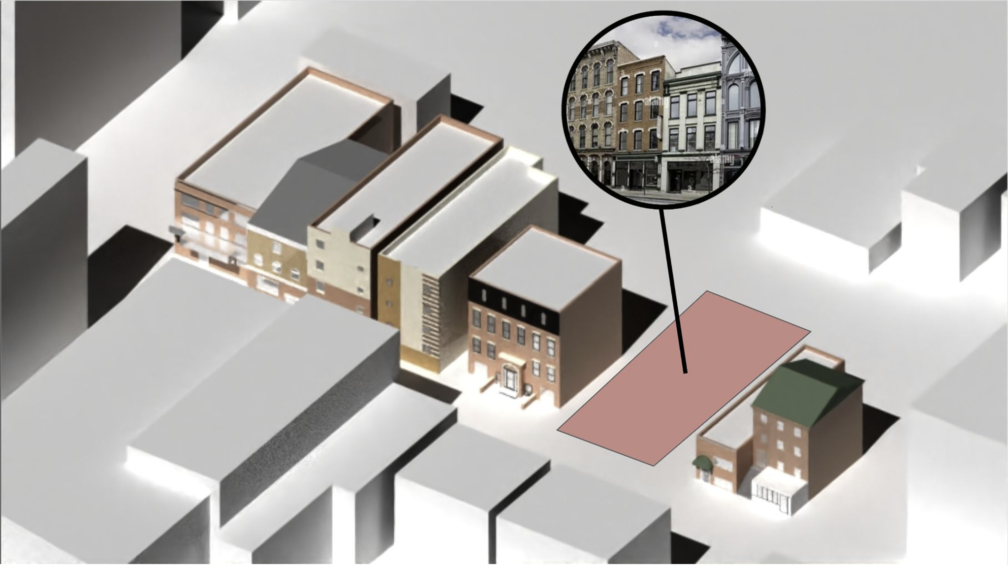
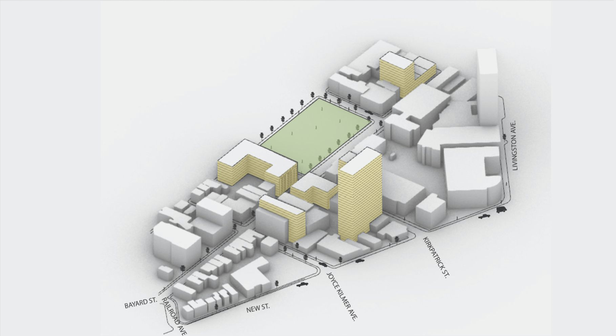
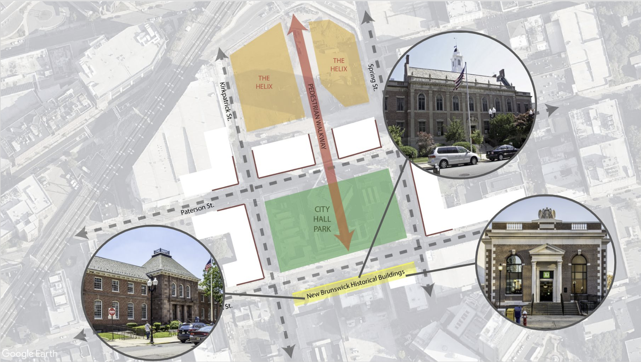
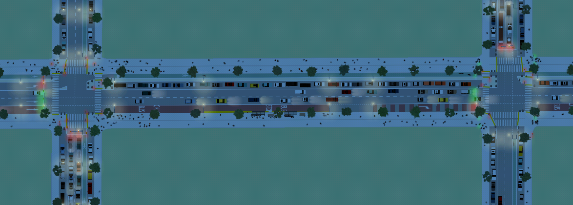
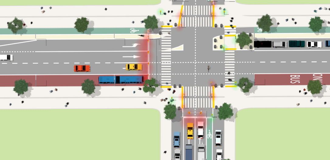
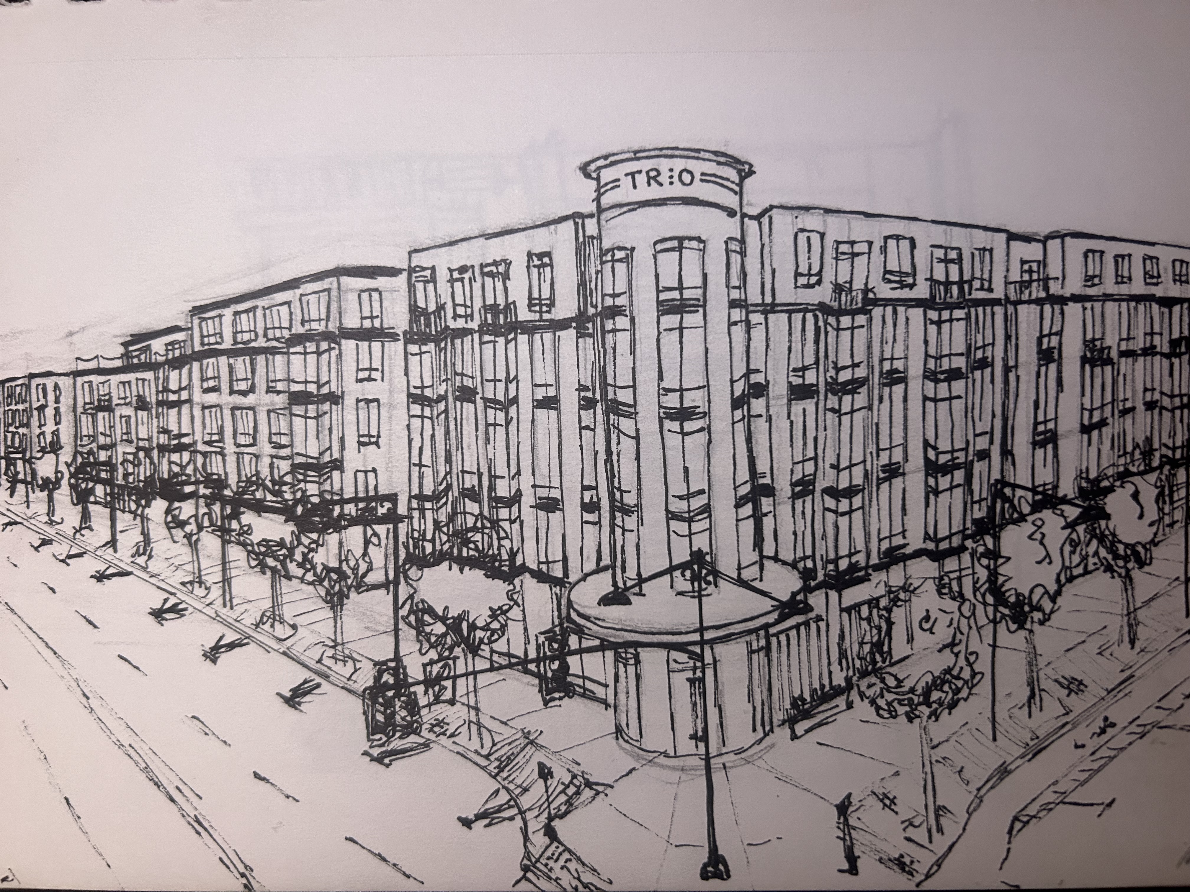
The Bayard Street corridor in New Brunswick was underutilized despite being in the heart of the city. This project—"Stitching the City"—proposes reconnecting the urban fabric through three interventions: infill housing, civic green space, and pedestrian-friendly design. The story unfolds in a sequence of analysis, intervention, and transformation.
I’ve supported New Jersey’s top transportation initiatives — from statewide safety plans to active travel programs — through data analysis, communications, and policy research.
As a Research Assistant at the Alan M. Voorhees Transportation Center (VTC), I’ve worked on multimodal safety, equity, and planning projects with direct applications to state policy and infrastructure. I contributed to New Jersey’s Target Zero safety strategy, Safe Routes to School resources, and statewide initiatives for micromobility, speed management, and land use reform. My work involves stakeholder engagement, policy analysis, graphic design, and data synthesis.
Image courtesy of VTC | New Jersey’s Target Zero Framework, a Safe System Approach with seven core focus areas.
Key Projects:
My work helped shape funding decisions, project scoping, and early-stage design for multimodal systems serving millions of riders.
As a Transportation Planning Intern at HDR Engineering Inc., I worked on major transit and infrastructure projects across the country. My role focused on spatial analysis, travel modeling, and policy compliance, using tools like GIS, Replica, FRA Connect, and FTA Stops. The internship sharpened both my technical fluency and ability to synthesize data for public agencies and engineering teams.
Image courtesy of HDR, Inc. | OC Streetcar rendering from the Santa Ana–Garden Grove corridor.
Key Projects:
Introducing EJB|DESIGNS at the Rutgers club fair — where we showcased our student-led work in urban sketching, digital rendering, and collaborative site design.
Graduate President, EJB|DESIGNS at Rutgers
Purpose: EJB|DESIGNS blends hand drawing with digital rendering to strengthen graphic communication in urban planning. We support students through hands-on practice, workshops, and career resources.
We prepare students for careers in planning and design by bridging traditional techniques with modern tools.
Using open-source intersection controller software, I simulated complex traffic behavior to evaluate design alternatives, pedestrian priority, and cycling safety. These projects reflect an iterative process of designing, testing, and visualizing urban movement patterns across various intersection typologies.
Over time, New York City's skyline has evolved dramatically. This hand-drawn series captures a century of architectural and economic growth from 1917 to 2020. Each drawing, completed in pencil, visualizes the era’s defining structures while showing the vertical expansion of the city.
Outside of software, I sketch urban environments — from streetscapes to transit hubs — as a way to understand space, form, and rhythm. These drawings reflect not only observation but imagination, and some have informed project ideas.
Growing up in Newton, MA, I voiced support for replacing a dangerous intersection with safer crosswalks and bump-outs at the Massachusetts State House. It was my first exposure to the planning process, and that small but formative moment stuck with me as the start of my journey in city-making.
Image: Redesigned intersection in Newton, MA with safer crosswalks, curb extensions, and bike markings.
Tracking Boston’s future, one beam at a time. This project documents major development and infrastructure changes across Greater Boston. From high-rises going up in Back Bay to adaptive reuse projects downtown, it offers updates on construction progress, design trends, and planning decisions shaping the region. Follow for updates on what’s next in the built environment.
Follow along: @boston.construction.